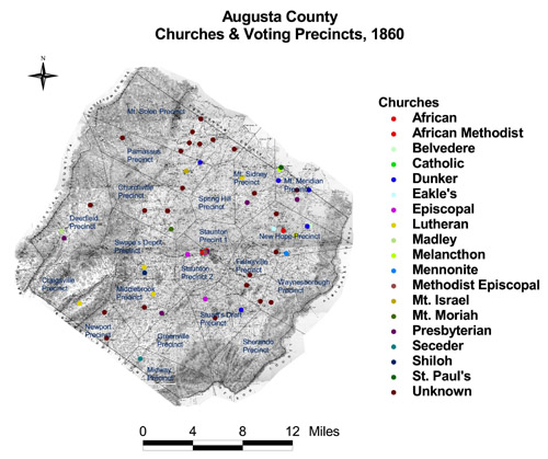
Augusta County: Churches and Voting Precincts, 1860
Church denominations in Augusta were primarily Methodist Episcopal and Presbyterian. The Hotchkiss map included African churches in Staunton formed after the Civil War. Nearly all other churches on the map were formed before the war. The diversity and locations of denominations in Augusta were also present at the precinct level. New Hope Precinct, for example, one of the largest and most wealthy and important precincts, included churches from all of the major denominations.
Click on the map for a larger image.

The map is derived from a Jedediah Hotchkiss map of Augusta County, published in 1870 and based on surveys completed "during the war." The Hotchkiss map has been georeferenced at the Virginia Center for Digital History, using ESRI Arc Info to produce a Geographic Information Systems map and database of households.
Note: Original precinct boundaries are not available. Precinct boundaries were established in the GIS using Thiessen polygons around precinct stations as central places.


