
Augusta County: Number of Slaves per Residence, 1860
This map shows the concentration of slaves on particular plantations. While slaveholders lived throughout the county with widely varying numbers of slaves per plantation, few planters owned more than 20 slaves.
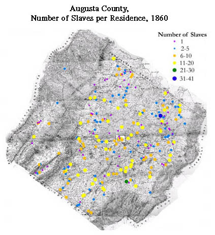
The map is derived from a Jedediah Hotchkiss map of Augusta County, published in 1870 and based on surveys completed "during the war." The Hotchkiss map has been georeferenced at the Virginia Center for Digital History, using ESRI Arc Info to produce a Geographic Information Systems map and database of households.