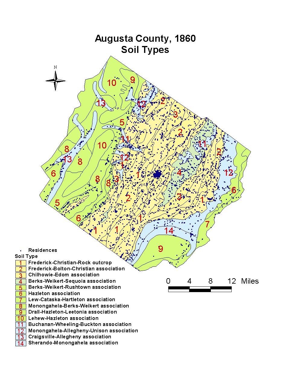
Augusta County: Soil Types
This map of Augusta County, Virginia, shows the soil types in the county. Augusta residents lived in every soil type in the county, but they concentrated their development in the richest soil areas. A relatively small number of residents inhabited soils unsuitable for agriculture. Where they did, they often located on the border of soil types, as close to better soils as possible.
Click on the map for a larger image.
The map is derived from a Jedediah Hotchkiss map of Augusta County, published in 1870 and based on surveys completed "during the war." The Hotchkiss map has been georeferenced at the Virginia Center for Digital History, using ESRI Arc Info to produce a Geographic Information Systems map and database of households.