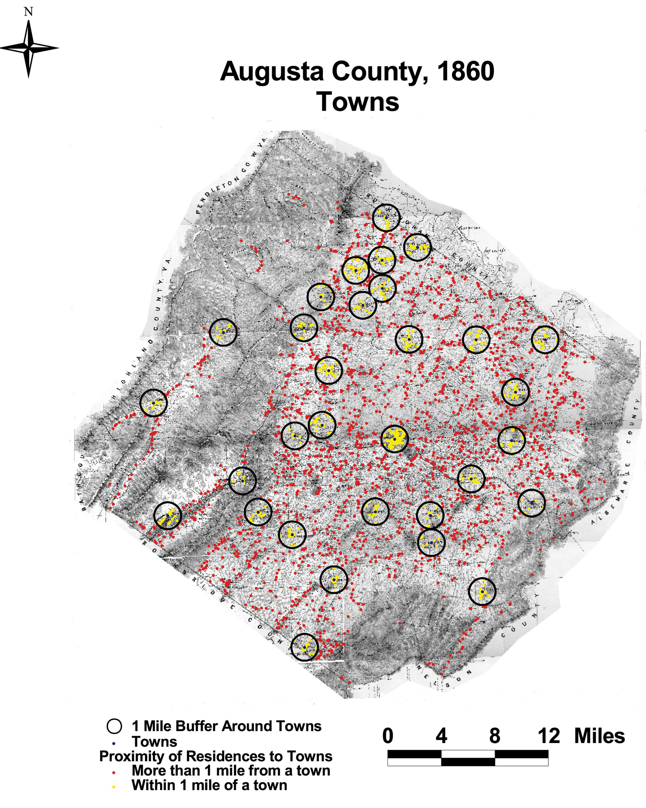
Augusta County: Towns
This map of Augusta County shows the towns in Augusta with a one mile buffer. No resident of Augusta lived more than 5.5 miles from a town or village.
Click on the map for a larger image.
The map is derived from a Jedediah Hotchkiss map of Augusta County, published in 1870 and based on surveys completed "during the war." The Hotchkiss map has been georeferenced at the Virginia Center for Digital History, using ESRI Arc Info to produce a Geographic Information Systems map and database of households.