
Augusta County: Residences with Slavery, 1860
This map presents the residences in Augusta County matched to the slaveowners census schedule and shows the uniform distribution of slavery across space in the county. The map also shows the widespread spatial distribution of slaveholders with 6-10 and 11-20 slaves. Nearly every part of the county had large and small slaveholders. The map also shows the extent of slavery and its proximity to nonslaveholders.
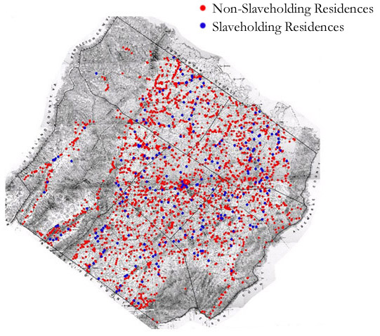
The map is derived from a Jedediah Hotchkiss map of Augusta County, published in 1870 and based on surveys completed "during the war." The Hotchkiss map has been georeferenced at the Virginia Center for Digital History, using ESRI Arc Info to produce a Geographic Information Systems map and database of households.