
Franklin and Augusta: Churches and Schools, 1860
This map set compares the churches and schools as central places in both counties with one mile buffers around these social institutions. Franklin's greater density of schools and churches, especially along its perimeter, corresponded to its more dense population and its greater commitment to free public education.
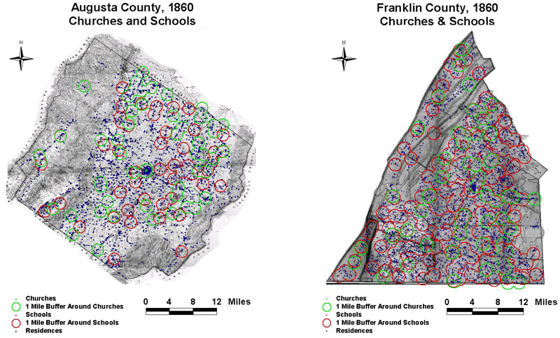
The maps are derived from a D. H. Davison map of Franklin County, published in 1858 and a Jedediah Hotchkiss map of Augusta County, published in 1870 and based on surveys completed "during the war." The maps have been georeferenced at the Virginia Center for Digital History, using ESRI Arc Info to produce a Geographic Information Systems map and database of households.