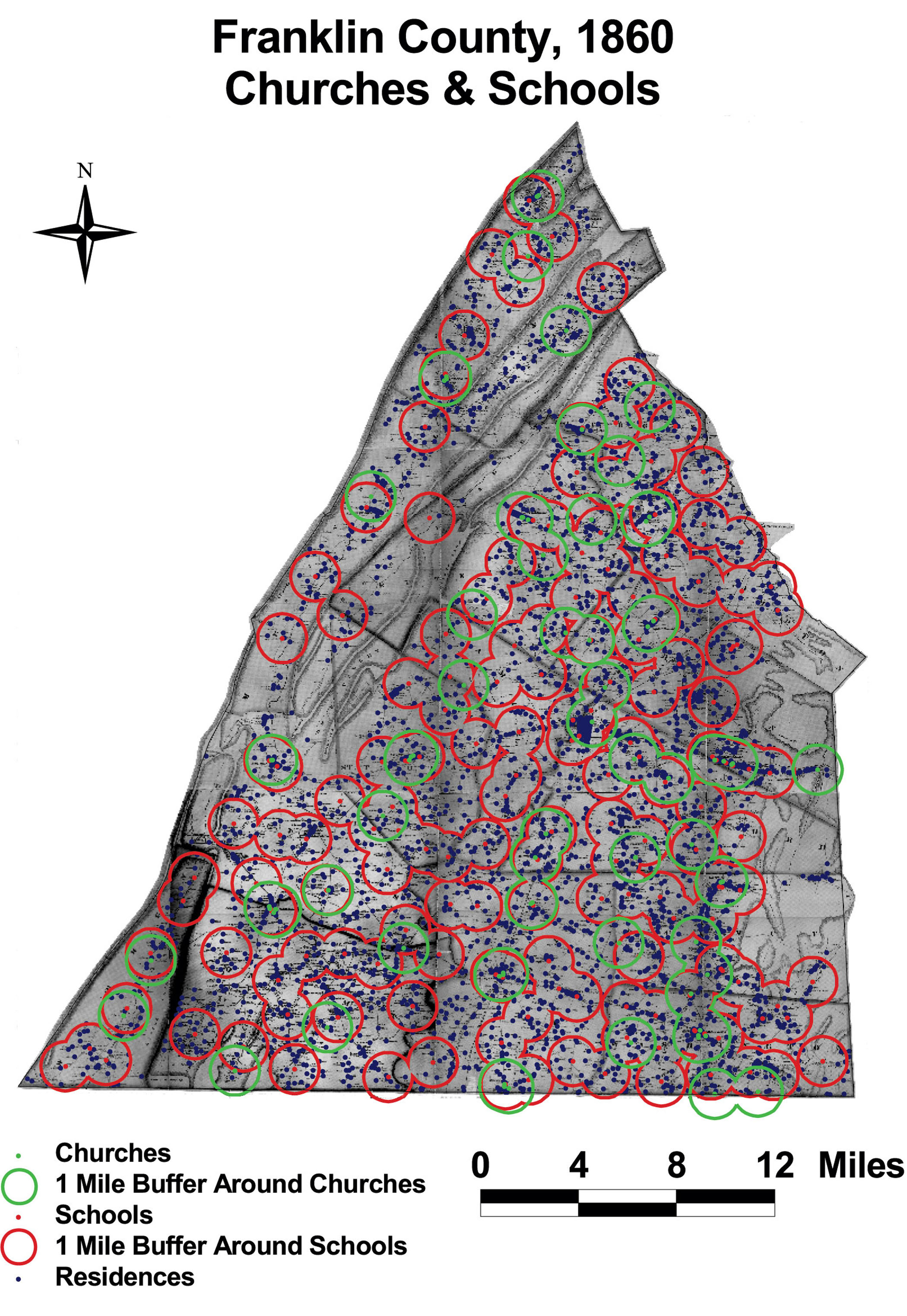
Franklin County: Churches and Schools, 1860
This map of Franklin County shows the density of churches and schools in the county. The circles indicate a 1 mile radius around each institution. No residence in Franklin County was more than 3 miles from a school and 5.5 miles from a church.
Click on the map for a larger image.
The map is based on GIS data and soil type data derived from a 1978 U.S. Geological Survey soil map. The map is derived from a D. H. Davison map of Franklin County, published in 1858. The Davison map has been georeferenced at the Virginia Center for Digital History, using ESRI Arc Info to produce a Geographic Information Systems map and database of households.