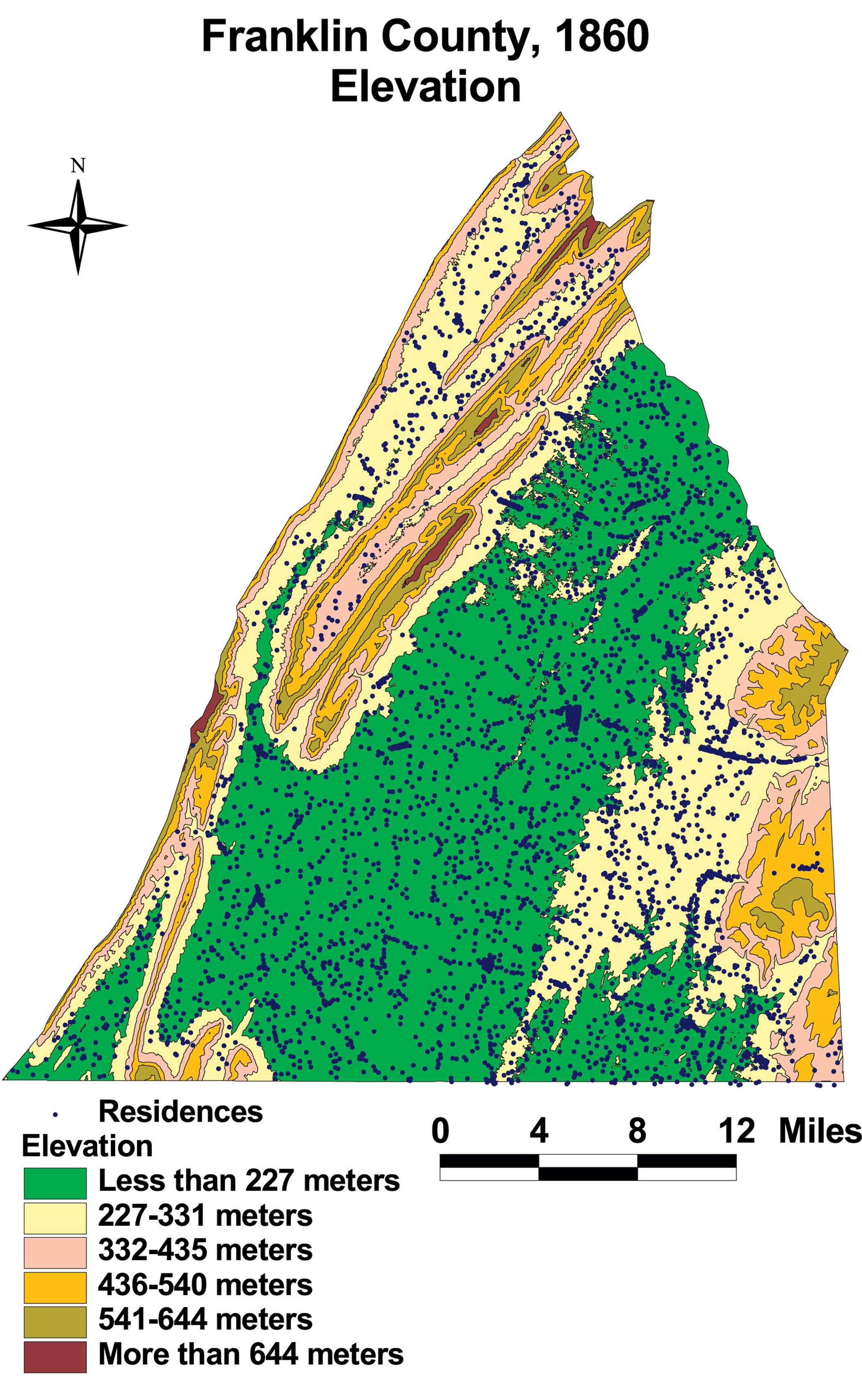
Franklin County: Elevation
This map of Franklin County shows the elevation of the county. Residents occupied dwellings at nearly every elevation.
Click on the map for a larger image.
The map is based on GIS data and soil type data derived from a 1978 U.S. Geological Survey soil map. The map is derived from a D. H. Davison map of Franklin County, published in 1858. The Davison map has been georeferenced at the Virginia Center for Digital History, using ESRI Arc Info to produce a Geographic Information Systems map and database of households.